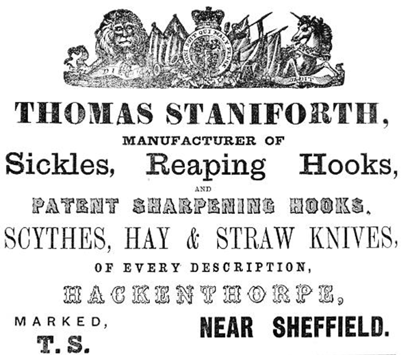
Thomas Staniforth & Co. Sickle works at Hackenthorpe.
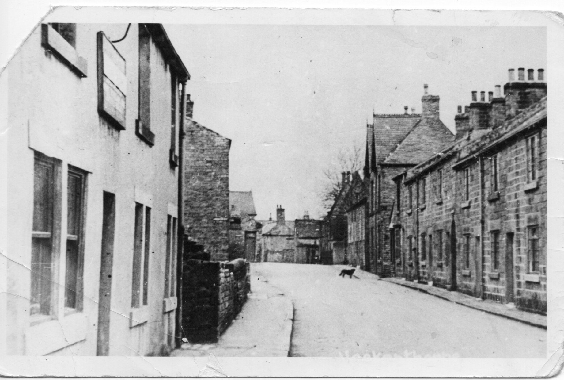 Main Street, Hackenthorpe
 The following is a list of local landmarks and places in the old village of Hackenthorpe, now a suburb of Sheffield. Some of these placenames are still used in the present day, others are long gone. Credit must be given to the late T.L Platts for the research on some of the older placenames.
Cuckoo
A name given to a row of terraced cottages at Bank View which are now demolished. Set amidst fields and overlooking Linley Banks they were reached by a lane from Church Lane. This was the ancient access route to the East Field, one of the Open Fields, for strip cultivation.
White Stile
A lane leading from the south side of Beighton Road which develops into a footpath to Mosborough via Hanging Lea. Named due to the unusual limestone gateposts at the junction of the path and Beighton Road.
Town Fields
These fields were at the western end of Main Street (at the junction of Main Street and Birley Spa Lane) stretching down towards the Shirebrook. It seems that they had been part of the Mill Field, another of the open-fields of Hackenthorpe used for strip cultivation
Narrow Lane
Was the beginning of a footpath from Hackenthorpe to Woodhouse via Birley East Pit. Starting from the Reading Room on Main Street, it was a narrow footway formed by a high wall marking the boundary of Hackenthorpe Hall grounds on one side and a low wall alongside the back of terraced cottages on the other side. At the top of Narrow Lane was a vacant plot of land called ‘The Old Barn’
The Ainey
The main road leading from Hackenthorpe village down to Beighton by what is now Carter Lodge School. The name Hany Gap is mentioned in a document of 1679; the field called Hanna Close became the Hackenthorpe Miners’ Welfare ground.
The Flashes
Were fields now built on, at the bottom of the Ainey hill on the south side of Beighton Road. Dodge Flash is mentioned in 1679 it means marshy ground.
Well Lane
Led from Main Street to the communal well at the extreme western tip of Hackenthorpe Wood. This was close to where Rainbow School now stands. The well remained capped in a field up until the Hackenthorpe Estate was built. Around the 1960s, the lane was also nicknamed Pig Lane due to the nearby farm.
Penny Loaf
Was a small copse alongside the Shirebrook at the foot of the spoil heap of Birley East Pit. It lay between Rainbow Forge and Cliff Wheel. In the middle of the trees was a circular clearing which was surfaced with red ash from the nearby tip. This ring was used for the illegal playing of pitch-and-toss, a gambling game. Footpaths radiated from this ring where lookouts were posted during play, to watch out for police who periodically staged a raid. This was certainly in use on Sunday mornings about 1940.
Church Lane
Oddly this thoroughfare is nowhere near to the church. It gets its name from the old stone built Infant Schoolroom which later became a Mission Room which pre-dated the church. The room still stands and has for many years been used as a pearl button factory, before that it was used as a grocery shop by Woodhouse Co-operative Society.
Utah
A terrace of houses so named on Church Lane, built by Thomas Staniforth & Co. in 1873 on the site of the Pingle, the original houses are now demolished.
Cam Bottom or Cam Oak
SOnly partially surviving this was a pleasant walk along the Ochre Dyke at the bottom of Brook Lane. There is a steep bank with stone steps and an off-shoot path with brambles and oak trees leading to the site of the old Sinking Pit at Moorhole Collieries. It derived its name from being the boundary (or bottom) of land belonging to Camm House off Mosborough Moor at the top of the hill near Ridgeway; Thomas Camm lived here towards the end of the seventeenth century
Carter Lodge
Before the Hackenthorpe housing estate was built in the nineteen fifties, Carter Lodge Farm stood on Spa Lane, this was a bridleway continuation of Main Street towards Normanton Springs. It was demolished in 1954 to make way for the new road and a parade of shops and houses on Birley Spa Lane. A Jonathan Carter is mentioned in 1704 he probably gave his name to the farmstead.
Delves
Fields near to where the Hogshead public house now stands; the ancient names here were over delves and nether delves. Delves means a place where excavation or digging has taken place – coal pit diggings.
Hutton Yard
A deed of 1833 conveyed to Mary Hutton two closes of land containing 11 acres. Mary, nee Mary Jermyn of Drakehouse had married Ezra Hutton a Ridgeway sicklesmith. She was widowed and her will of 1852 left ten terraced stone cottages, which were erected on a part of this land to form Hutton Yard and a barn, this would be the ‘Old Barn’ which stood in Brammall Yard adjacent, almost opposite the present Sportsman Inn.
The will of 1852 described the cottages as newly erected, eight of them fronted the Main Street and two were at the back. In 1870 the following were tenants from year to year and paid the following rents – Thomas Booth £12 12 0d, this was also shop premises; G. Atkin, M. Rippon, J. Martin, T. Martin, G. Staniforth, G. Havenhand, J. Cartledge, J. Carnall and J. Booth who each paid £6 p.a. giving a total of £66 12 0d. Henry Carnall was tenant of the rest of this land paying £13 p.a.
In July 1886, the following were tenants – George Havenhand (in the shop premises), Ann Rippon, Tom Turner, John Martin, Joe Booth, Jemima Staniforth, Elizabeth Mills, Mary Rippon, Joe Carnall, Mary Martin and Henry Carnall still occupied the land. All the annual rents were the same as in 1870, sixteen years earlier.
Hearse House and Village Pound
These were both adjacent to the present Village Green at the junction of the school garden and Brook Lane they were in a dilapidated state in 1895. The public hearse had been used to convey the Hackenthorpe deceased to Beighton Churchyard as there was no burial ground at Hackenthorpe.
Thomas Staniforth & Co. Sickle works at Hackenthorpe.
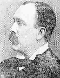
Thomas Worsley Staniforth, Hymn composer.
If you are a Staniforth, or if you know of any Staniforths that would be willing to share any information or photos, please feel free to get in touch using the contact details below.